Difference between revisions of "Star Charts"
| Line 11: | Line 11: | ||
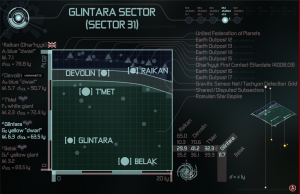
[[Image:Fs-sc-1_Glintara_Sector_(Sector_31).png|left|thumb|05 25 972 87 21505.29 ''fs-sc-1'' [[Glintara Sector]] [[Glintara Sector|(Sector 31)]]]] | [[Image:Fs-sc-1_Glintara_Sector_(Sector_31).png|left|thumb|05 25 972 87 21505.29 ''fs-sc-1'' [[Glintara Sector]] [[Glintara Sector|(Sector 31)]]]] | ||
| − | [[Star Fleet Cartography|Star Fleet Cartography’s]] star chart number 05 25 972 87 21505.29 depicts the relative positions in [[Space|space]] of the following explored astronomical objects: [[Belak|Belak,]] [[Devolin|Devolin,]] [[Glintara|Glintara,]] [[Raikan]] [[Dhar'hyyk|(Dhar’hyyk),]] and [[T'Met|T’Met;]] and the following installations: [[Earth Outpost 12|Earth Outpost 12,]] [[Earth Outpost 13|Earth Outpost 13,]] [[Earth Outpost 14|Earth Outpost 14,]] [[Earth Outpost 15|Earth Outpost 15,]] [[Earth Outpost 16|Earth Outpost 16,]] and [[Earth Outpost 17|Earth Outpost 17.]] | + | [[Star Fleet Cartography|Star Fleet Cartography’s]] [[Star Charts|star chart]] number 05 25 972 87 21505.29 depicts the relative positions in [[Space|space]] of the following explored astronomical objects: [[Belak|Belak,]] [[Devolin|Devolin,]] [[Glintara|Glintara,]] [[Raikan]] [[Dhar'hyyk|(Dhar’hyyk),]] and [[T'Met|T’Met;]] and the following installations: [[Earth Outpost 12|Earth Outpost 12,]] [[Earth Outpost 13|Earth Outpost 13,]] [[Earth Outpost 14|Earth Outpost 14,]] [[Earth Outpost 15|Earth Outpost 15,]] [[Earth Outpost 16|Earth Outpost 16,]] and [[Earth Outpost 17|Earth Outpost 17.]] |
<br clear=all> | <br clear=all> | ||
<br clear=all> | <br clear=all> | ||
Revision as of 22:42, 3 June 2015
Welcome to Star Fleet Cartography’s library of star charts. Here you will find star charts that depict the relative positions in space of explored astronomical objects, and a number of installations.
(You might be looking for topographical maps that depict surface features of explored astronomical objects.)
Unless otherwise indicated, the SECRAT of all of the star charts available to you from here is LEVEL 1, RESTRICTED.
See also “Star Chart Guide,” below.
Library Contents
Star Fleet Cartography’s star chart number 05 25 972 87 21505.29 depicts the relative positions in space of the following explored astronomical objects: Belak, Devolin, Glintara, Raikan (Dhar’hyyk), and T’Met; and the following installations: Earth Outpost 12, Earth Outpost 13, Earth Outpost 14, Earth Outpost 15, Earth Outpost 16, and Earth Outpost 17.
Star Chart Guide
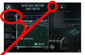
The header displays the most common name, or names—sometimes a number—of the sector plane depicted. In fine print, next to the common name, is the document’s official registration number. The registration number is a three-part code that identifies (1) the dataset by filename; (2) the sector plane by grid, quad, block, and sector; and (3) the Stardate of the document’s release to SECRAT LEVEL 1.
The window displays the explored contents of the sector plane, including the explored contents of all sectors “above” and “below” the sector plane, but within the Milky Way. Like looking at star charts of the Alpha, Beta, Delta, and Gamma Quadrants, looking at star charts of sectors is like hovering over the Galaxy and looking at all of the sectors, from the “top” ones to the “bottom” ones, but through the window of the sector plane.
The legend displays a list of items in the window, describes each item, and points to each item.
The catalogue usually originates along the left margin, beneath the header. There, it displays the most common name, or names—sometimes a number—of the stars or star systems in the window. Following the name, a label depicts or describes the principal affiliation or status of the world. Next, the catalogue displays the world’s primary stellar classification, along with a basic description of its type. (Note that the primary of inhabited star systems refers to the star that hosts the principal planetary system, not necessarily to the star that is the primary of the star system. If applicable, superscripted to the primary classification is the classification of important additional star types in binary and multiple star systems. Note, too, that “dwarf,” in quotation marks, refers to a main sequence “dwarf,” not to a white, red, or brown dwarf.) Following the basic description, the catalogue displays the world’s absolute visual magnitude (Mv). Next, it displays the world’s distance to Sol (Earth), as measured in light years (dSOL). From there, the catalogue usually continues along the top margin, to the right of the header, where it displays the world’s x-, y-, and z-coordinates, as measured in light years. (See also the Astronomical Terms Database.)
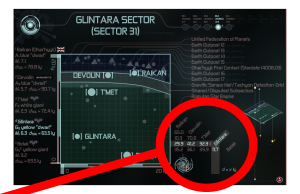
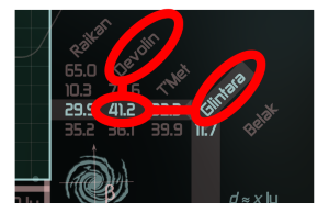
The distance chart is a list of the worlds displayed in the window and the distances between all of them. See the next illustration about how to find the distance between any two worlds in the list.
To find the distance between two worlds listed in the distance chart, simply make a horizontal or a vertical, not a diagonal, line on the chart from one world to the other, in the direction of the other. Do the same for the other world until the two lines meet somewhere in the chart. The chart displays the distance between the two worlds where their two lines intersect.
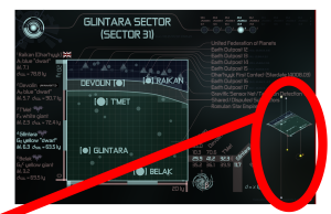
The three-dimensional diagram displays the positions of the stars in three dimensions. Few stars are actually on the sector plane, as depicted. Rather, they are either “above” or “below” it, sometimes several sectors “above” or “below” the plane. This diagram is a useful tool to help visualize the relative distances between the stars.
Contact
See under the “Contact” heading on the Star Fleet Cartography page.
